


 Live Chat
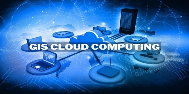
We all are well aware of the fact that Cloud Computing is dominating the IT industry and there is a massive demand for Cloud Hosting that is arising. With continuous advancement and innovations, the cloud industry is getting broader while new features and developments are emerging. One of the greatest innovations that has recorded success in the digital landscape is GIS cloud hosting. GIS cloud applications are distinct and easy to use for non-GIS professionals, which qualifies them as the optimal solution for decision-making, planning, and emergencies.
Recently conducted studies have concluded that hybrid cloud usage in GIS has shown significant growth and is expected to grow by 17% through 2023.
In this comprehensive guide, you’ll learn about the synergies between GIS and cloud computing, including how it has revolutionized spatial analysis and mapping, its practical applications, and the benefits it offers to businesses and organizations worldwide.
How do you define GIS Cloud Hosting?
GIS cloud hosting is the practice of blending Cloud Hosting with GIS applications. Geographic Information System (GIS) based applications work on integrated systems of computer hardware, software, and spatial data that could be topographic, demographic, tabular, graphic image, or digitally summarized. Through this merger, traditional applications of GIS can be combined with state-of-the-art cloud ecosystems that can transform spatial and non-spatial applications and information. The combination of these blends the power of geospatial data and the vast scalability of cloud infrastructure to deliver cutting-edge solutions across various industries, from urban planning and environmental management to disaster response and business intelligence.
What are the types of GIS Cloud Hosting?
Just like conventional Cloud Hosting, GIS Cloud Hosting is also Categorized into 3 main types that are Public, Private, and Hybrid. Below is a quick glance at these 3 cloud models.
GIS Public Cloud: This is a cloud service that enables all GIS-related features and functionality to be available publicly and can be accessed by all users. In the GIS public cloud, each user’s data is kept separated by the means of virtualized servers but is stored on the same equipment.
GIS Private Cloud: In GIS Private Cloud, the functionalities and features are accessible only by a single entity to whom the server is dedicated.
GIS Hybrid Cloud: As the name suggests, this is a blend of public and private GIS cloud that offers all the services and functionalities in a blended manner.
As we have understood the main types of GIS cloud, it’s better to understand what advantages it offers.
Easy Scalability
Since scalability is one of the most prominent features of Cloud Hosting, it applies to GIS as well. Through GIS Cloud Hosting, GIS-based applications can be easily scaled up to down the basis of the requirement. One of the main advantages is that organizations can also set up a development environment that only runs during business hours or removes servers to scale down the environment during non-peak times.
Increased productivity
GIS Cloud Hosting can significantly increase overall productivity and enable organizations to effectively manage their workflow. By allowing more users to access and use the program, more work may be finished quickly without requiring several trips to different places.
Cost Savings
Since GIS cloud hosting does not require travel, there are significant savings in travel costs as the data can be accessed remotely from anywhere in the world. Additionally, employees will have more flexibility in where and when they work.
Better security
We all know security is one of the topmost priorities of our data and security cannot be compromised by any means. GIS Cloud hosting offers enhanced security as data can be encrypted online with greater ease in comparison to traditional storage media like CDs or hard disks.
Requires Less Maintenance
With Cloud GIS you don’t have to maintain a server – the provider takes care of it. This allows you to focus on the things that matter – maintaining your data and providing beautiful and accessible web maps with the most up-to-date and compelling data for your community to use.
Easier to Keep updated
Since you do not have to keep the infrastructure updated regularly, it is the responsibility of the vendor to keep all servers and physical hardware up to date. They regularly monitor the health of GIS and cloud systems and troubleshoot if any technical issue arises. This makes GIS Cloud Hosting an ideal choice and keeps the system running all the time with minimum downtime.
Enhanced Data processing and analysis
Cloud-based GIS platforms provide the optimal computing power required for conducting data processing and analysis. With the help of GIS Cloud Hosting, users can easily run complex geospatial algorithms, perform spatial queries, and create custom workflows using cloud-based GIS software.
Seamless Visualization and Mapping
Cloud-based GIS tools provide interactive map visualization capabilities that can be used by different organizations for different purposes. GIS cloud hosting allows users to create dynamic maps, apply different layers, and integrate location-based data into their applications or reports.
Now that we have understood what GIS Cloud Hosting is and what are its advantages, let’s take a quick look at what are its applications and practical usage.
Urban planning and development
Urban planners use cloud-based GIS to analyze demographic data, traffic patterns, and land use to make informed decisions about urban development. It allows the creation of 3D models to simulate city growth and optimize infrastructure.
Environmental management:
GIS in the cloud helps monitor environmental changes such as deforestation, climate change, pollution levels, and natural disasters. Remote sensing data from satellites can be processed and analyzed in real-time, enabling rapid response to environmental crises. Analyzing patterns and data can help disaster relief organizations and governments predict natural disasters such as hurricanes, cyclones, earthquakes, forest fires & more on time and prepare themselves accordingly. Through real-time mapping and analysis, evacuation planning, resource allocation, and damage assessment can be done effectively.
Agriculture
GIS cloud hosting can have a major impact on the agricultural industry and optimize the entire value chain. Precision farming relies on cloud-based GIS to streamline crop management. Farmers can analyze soil quality, weather conditions, and historical data to make data-driven decisions about planting, irrigation, and harvesting. This can help boost their yearly produce and prevent agriculture of the wrong crops in the wrong season.
Logistics and Supply Chain Management
Logistics is a vital sub-function of the supply chain industry and can cause various disruptions in global trade if demand-supply equilibrium is not maintained. Logistics companies therefore use GIS in the cloud for route optimization, fleet management, and real-time tracking of shipments. It increases efficiency and reduces transportation costs while enabling organizations to manage their logistics effectively.
Business Intelligence
Companies use location-based data and spatial analysis to gain comprehensive insights into customer behavior, market trends, and sales territory optimization. Cloud-based GIS tools enable the integration of geospatial data into business intelligence dashboards. This can help businesses harvest untapped markets and monitor their business performance at various locations which can eventually improve their business significantly.
Natural Resource Management
Natural resources are continuously depleted and they must be used in a sustainable manner to avoid complete depletion and exhaustion. Governments and organizations use GIS-based systems and data to track, monitor, and manage natural resources such as forests, water bodies, and wildlife habitats. This helps in sustainable resource management and conservation efforts while contributing to sustainable development.
Final Thought
Cloud computing has been in the picture for a long time and has been continuously used by many different industries to map and analyze geographic data from remote locations. GIS cloud hosting is a subset of cloud hosting that applies to the geospatial industry. We are aware of the fact that the applications and use of geospatial technology have continuously increased in recent years. This is where GIS cloud hosting plays a key role in providing seamless access to geospatial data from anywhere, anytime, and from any device.
Some of the major advantages associated with GIS Cloud Hosting are its cost-effectiveness, increased productivity, better security, requirement of less maintenance, easier of keeping updated, enhanced Data processing and analysis, seamless visualization and mapping, and much more. GIS cloud hosting can have various applications such as Urban planning and development, environmental management, agriculture, business intelligence, and many more.
Businesses, governments, and organizations that leverage the power of GIS in the cloud gain a competitive advantage by making data-driven decisions, optimizing operations, and solving complex challenges. As technology continues to advance, the possibilities for GIS in the cloud are limitless, promising innovative solutions to our world’s most pressing problems.