


 Live Chat
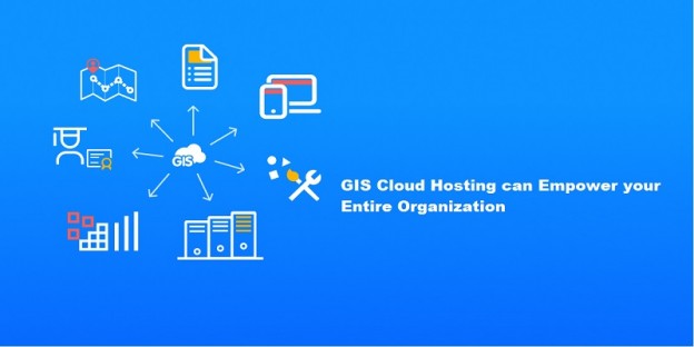
Table of Content
The value of data and its appropriate management cannot be emphasized in today’s ever-changing corporate world. Geographic Information System (GIS) technology has transformed the way businesses acquire, analyze, and use location-based data. Businesses are increasingly turning to GIS cloud hosting services to realize the full potential of GIS. This move not only improves data accessibility, but it also enables organizations to simplify processes, make data-driven choices, and gain a competitive advantage.
What is GIS Cloud Hosting?
GIS Cloud is a collaborative mapping tool and the first cloud-powered web-based GIS. It offers complete desktop GIS functionality enhanced via the web. GIS Cloud apps allow you to simply and quickly visualize data, perform analyses, and explore geographic information. Map Viewer, Map Editor, Crowdsourcing, Mobile Data Collection, GIS Cloud Publisher for QGIS, Map Portal, Geocoder, and GIS Cloud Publisher for ArcMap are just a few of the tools offered in GIS Cloud to help you manage and visualize your data.
The GIS Cloud platform’s key aims are as follows: to facilitate the transmission of geographical information between users and to provide a simple way to analyse this information independent of the users’ location. GIS Cloud gives you access to the entire capabilities of desktop GIS, allowing you to do geospatial analysis, spatial intelligence, create customized mapping reports, publish geographic analysis on the web, and many other tasks.
Another option is to set up your own GIS Cloud platform. We provide customised installations behind the ON-PREMISES firewall for those that want private cloud solutions.
The need for GIS cloud
GIS cloud offers authoritative tools that may assist many enterprises, particularly where optimisation and cost reduction are vital. Some fundamental elements that distinguish GIS cloud as a genuine competitor for the next generation GIS computing paradigm are as follows:
- Facilitating Application Infrastructure: GIS cloud offers a dedicated framework for geo-enabling business data and systems. Organizations with prior GIS investments can leverage GIS cloud resources to enhance support, simplifying the analysis, authoring, and management of business and geographic data. GIS cloud extends support through web services and application hosting, ensuring that organizational geographic data is easily accessible, published, and utilized.
- Empowering Technology Infrastructure: GIS cloud, as a computing paradigm for geographic data, empowers subscribers to harness virtual, sophisticated hardware and software resources, providing comprehensive access for data creation, analysis, editing, and visualization. Collaborative tools further amplify the integration of GIS across local and global offices.
- Reducing Support and Maintenance: Implementing in-house GIS often demands specialized skills and extensive technical capabilities. GIS cloud negates the need for in-house GIS expertise for fundamental geo-information access functions. For organizations already equipped with GIS capabilities, this complement allows highly skilled in-house staff to focus on more complex responsibilities and services. This not only eliminates substantial direct implementation costs but also reduces the ongoing in-house IT support and maintenance burden.
- Lowering Usage Costs: GIS cloud offers advanced geospatial technology infrastructure, services, and data to consumers without requiring substantial initial investments in time or cost or ongoing maintenance expenses. This is particularly significant because enterprise GIS deployment costs can be prohibitively high, making it a primary reason many organizations do not offer GIS solutions to their clients. GIS cloud significantly lowers the barriers to entry.
- Harnessing Data Control: GIS is fundamentally based on imagery and topographic mapping, often sourced at considerable expense from spatial data vendors. GIS cloud integrates foundational data into core services accessible through standard internet-enabled devices. The elastic nature of GIS cloud allows users to readily scale their capacity up or down as needed. The storage and management capabilities within GIS cloud are conducive to input, analysis, and manipulation of spatial information, greatly benefiting users.
- Location-Independent Resource Pooling: GIS cloud excels in providing location-independent resource pooling. Processing and storage demands are balanced across a shared infrastructure without specific resources allocated to individual users. The pay-per-use model of GIS cloud ensures that consumers are billed in accordance with their utilization of computing power, bandwidth, and storage.
- Data Conversion and Presentation: Data conversion services involve transforming and importing data from one format into a new database. This process is critical for GIS but traditionally requires substantial in-house technical resources, encompassing infrastructure, software services, and skilled manpower. GIS cloud offers spatial data conversion services without necessitating in-house resources. Furthermore, it introduces advanced features like 3D spatial information presentation, eliminating the conventional “pancake perspective” that flattens rich geographical data into a forced, planar geometry.
How GIS cloud hosting can help in empowering the business
Empowering GIS Professionals
This new design, Web GIS, enables GIS professionals. It enables you to broaden your effect across your organisation by creating applications that not only serve you, but also knowledge workers, executives, and casual workers, as well as engage citizens. Web GIS, by exploiting the entire new world of the open data community, actually gives everyone a geographic edge.
Web GIS enables GIS specialists, increasing their effect across the organisation and giving everyone a geographical edge.
You already have this edge as a GIS specialist. You own the domain name.I want you to think about how you can share your subject expertise with others.
That, in my opinion, will be the huge event that transforms everything.
Transforming Organizations
This Web GIS pattern is transforming organizations, and we can already see the beginnings of it today. Web GIS is already being used by a number of organisations to provide shared information and enhance collaboration, and it is actually altering the way organisations work.
Traditionally, the IT infrastructure was hierarchical. It was stovepiped. We had many departments that functioned at the operational and planning levels, and then a few at the management level who could make judgements.
It worked really well and will continue to function effectively for some organisations.
But there’s also something else going on. With this new Web GIS pattern, we’re able to open access in organizations so everybody can use it and benefit from it. We’re fostering collaboration around a common business asset: geographic knowledge. This is transformational to organizations.
Creating Connections
This Web GIS model is not only revolutionizing data utilization but also fostering collaboration among various organizations. The city of Los Angeles epitomizes this progressive approach. The mayor’s visionary perspective goes beyond merely making data accessible; he envisions making data services openly available. This paves the way for local startups to leverage government data and seamlessly integrate it into innovative solutions. Moreover, the mayor aims to extend this data accessibility to schools within the city, ensuring that students have direct access to valuable datasets that the government invests significant resources in maintaining.
This forward-thinking initiative holds the potential to fuel innovation, empower local businesses, and enrich educational opportunities for the younger generation. And likewise, citizens and NGOs and utilities, and even businesses, creating a new kind of community around the concept of shared geographic knowledge.
That’s a big idea, and I’m sure many of you’ve actually had similar visions. But with this new pattern—this sort of overlay on your existing systems, this pattern of systems and engagement—it can actually be accomplished rather easily.
Trends and Innovations in GIS Technology
GIS technology is becoming more prevalent in all aspects of our life. Let’s have a look at the most recent GIS developments and breakthroughs. Geographic information systems (GIS) have grown dramatically in recent years, and the way we acquire, analyse, and display data has developed and become more efficient.
Drone-based data analysis and machine learning algorithms, for example, are broadening the scope of GIS applications in business and other fields. GIS technology is becoming more accessible thanks to the following technologies:
- Cloud computing
- Mobile GIS
- Machine Learning
- Drone-based GIS
- 3D and digital twins
- Automation
- Self-drive cars
- Real-time and extensive data analysis
- Miniaturisation of sensors
- Artificial Intelligence
- AR technology
Miniaturization of sensors:
Sensor miniaturization is propelling market expansion to new heights. They have shown to be highly efficient, cost-effective, and user-friendly because of their compact size. These may be used to capture real-time data in an efficient and cost-effective manner.
Artificial Intelligence and Machine Learning:
Managing unstructured and chaotic data may be challenging, but with the aid of AI and ML, hidden patterns that may have gone unnoticed can be discovered. These technologies aid with the organization and structure of data, making it more understandable to consumers. GIS seeks not just to improve the existing world, but also to create a more resilient and sustainable future. As a result, rather than just acquiring information, AI and ML play an important role for GIS experts by easing data management and interpretation.
Real-Time and Big Data Analysis:
Real-time data analysis in GIS projects integrates various data sources like sensors and satellites. It analyses and analyses data, maps it, and delivers insights for fast decision-making. Automation, predictive analytics, and integration with IoT and AI expand its possibilities for improved results.
Self-Driving Vehicles:
The trend of driverless vehicles is rising daily. The sector is rapidly evolving, and GIS plays a vital part in this. LiDAR and Radar are employed to operate them, and geographical information is used to assure their navigation.
GIS is essential in self-driving vehicles for creating detailed high-definition maps, integrating real-time data from GPS, sensors, and cameras, determining optimal routes, enabling precise localization, setting geofencing boundaries, identifying hazards, facilitating remote fleet management, and conducting algorithm refinement simulation tests. These GIS applications improve autonomous driving navigation, decision-making, and overall safety.
Geospatial AI:
Geospatial AI, at its heart, employs AI algorithms to evaluate and analyse massive volumes of geospatial data, which includes geographic information such as maps, satellite pictures, GPS data, and other spatial data sources. Geospatial AI can automatically discover patterns, detect changes, and forecast future events or outcomes relating to specific areas by employing AI techniques such as machine learning and deep learning.
Geospatial AI offers a wide range of applications. It may be used in urban planning to optimise infrastructure construction, environmental monitoring to track changes in ecosystems, and disaster response to evaluate the effects of natural disasters and effectively coordinate relief activities. Furthermore, geospatial AI is important in agriculture, transportation, logistics, and even marketing since it allows firms to make location-based decisions and improve their operations.
GIS in the Cloud:
While the primary use of GIS cloud computing is often storage, such as remotely viewing and analysing geographical data using desktop GIS software, the usage of GIS as a service is fast expanding.
One significant advantage of using cloud technology is the potential to capitalise on economies of scale. Through virtualization, service providers can offer GIS features to numerous users, all using the same hardware while accessing private instances of the cloud environment. This efficient technique enables the supply of GIS services to a wide user base at a cheap cost.
Geospatial AR technology:
Geospatial AR (Augmented Reality) is a system that augments the user’s perspective of their surroundings by combining real-world geographic data with computer-generated information. It superimposes digital items such as photos, graphics, or data onto the real-world environment using a device such as a smartphone or augmented reality headgear. Geospatial AR makes use of GNSS or other location-based technology to precisely position and align virtual items with the actual environment.
Users may engage with and explore their environment in new ways because of this technology. Users can, for example, access extra information about buildings or landmarks by pointing their smartphone at them, see virtual directions superimposed on real streets while navigating, or discover subsurface utilities or secret infrastructure under the surface by pointing their device at them. Geospatial augmented reality has several uses in navigation, urban planning, architecture, tourism, gaming, and other industries, making it an indispensable tool for boosting spatial knowledge and decision-making.
Conclusion:
By seamlessly integrating geographical data and powerful analytics, Geographic Information Systems (GIS) have revolutionized ordinary corporate processes. We have seen the transformative impact of GIS in optimizing site selection, improving supply chains, directing marketing efforts, minimizing risks, managing assets, and making informed decisions via real-world instances. Organizations gain a competitive advantage, improve client experiences, and drive success in today’s changing business landscape by utilizing GIS technology. GIS’s unlimited capabilities unleash the potential of location-based information and catapult organizations to new heights.